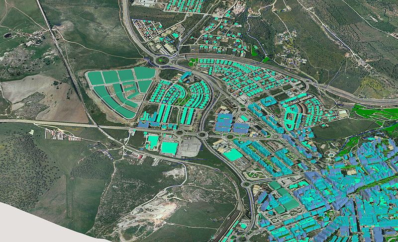
GIS-driven decisions
Location-based Analysis
Use GIS-style insights across industries—planning layers, infrastructure overlays, and spatial context for better decisions.
What you get
Highlights
Planning layers
View constraints like easements and other planning-related overlays.
Infrastructure overlays
Understand networks like electricity, gas, and pipelines.
Topography context
Use contour layers and satellite views where needed.
Bring spatial context into every decision
Use map-based insights to understand constraints and opportunities—useful for planning, development, infrastructure, and analysis workflows.
- Work from a single spatial view of key signals
- Combine overlays to uncover hidden constraints
- Make decisions with clearer context
Analyse layers and boundaries in one place
Switch layers and review boundaries to support deeper evaluation—especially when risk, constraints, or approvals matter.
- Use planning and easement overlays
- Review infrastructure networks and context
- Validate assumptions with spatial evidence
Support reporting and stakeholder alignment
Turn complex spatial information into decision-ready insights—so teams and stakeholders can align faster.
- Clear summaries for approvals
- More consistent evaluation across sites
- Reduce back-and-forth with shared context
Book a demo
Want to see Zestak in action? Fill in the form below and we’ll walk you through the workflow for your use case.